St. Francis Levee District

St. Francis Levee District
Progress 2016
Created in 1893 by the Arkansas State Legislature, the St. Francis Levee District serves as the primary flood control mechanism for seven Mississippi River Delta counties in Eastern Arkansas — Craighead, Crittenden, Cross, Lee, Mississippi, Poinsett and St. Francis counties. The St.
Francis Levee District is governed by 19 board members and maintained by Chief Engineer Rob Rash and the Levy District staff and crew.
Reclaiming the swamp and overflow lands in the Mississippi River Delta required draining those lands and building levees to mitigate the inevitable floods that periodically occurred.
Without drainage, the land was useless for farming.
Early residents realized that once the land was cleared of the timber and drained, the rich alluvial soil would be productive for a variety of crops, especially cotton.
Initially, early settlers had attempted to build makeshift barriers to halt the powerful flood waters, but these attempts were ultimately useless. Although the line of levees along the Mississippi River expanded during the nineteenth century, the water always found a weak spot and inundated the region.
Attempts at flood control in the region date back to 1879 when Congress created the Mississippi River Commission to establish a unified flood control plan. In cooperation with the U.S.
Army Corps of Engineers, the commission’s goal was to build higher levees based on previous flood heights and improve their quality.
Between 1905 and 1915, the Arkansas General Assembly passed laws to create a program of flood control in Arkansas’s Mississippi River Valley.
Many of these early drainage districts found it difficult to construct adequate levees to halt the overflow of the Mississippi River due to both the natural landscape and opposition from land and livestock owners, some of whom were known to cut the levees and sabotage the plans of the drainage districts.
However, the need for better flood control won out, to the benefit of the local population, where flooding was prevalent and a large amount of land was regarded as a hopeless permanent mosquito and malaria infested swamp.
In addition, many of the early levees were poorly constructed and were susceptible to collapse when pounded by violent floods.
However, through perseverance, the levee district became successful and enabled the area to become one of the most productive farming region in the nation.
During the Flood of 1927, the levees failed, and the whole system had to be revamped. In the modern era, there has been a great deal of renovation to the system of levees and drainage districts.
The St. Francis Levee has effectively prevented flooding and provided of stability to the region.
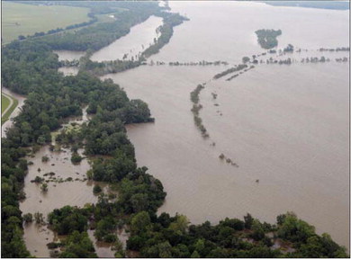
The levee endured the greatest test of its integrity in nearly a century last year during the Great Mississippi River Flood of 2011. Water reached a record 48.7 feet along the levee, surpassing even the 1927 flood that killed 500 people and inundated 16.8 million acres along the river’s swollen shores. By comparison. In a testament to the success of the levee system, despite the higher water level, the area flooded in 2011 was only 38 percent of the 1927 flood (6.35 million acres).
According to Rash, efforts to continue to maintain and improve the quality of protection the St. Francis Levee District provides. Year-round monitoring and maintenance go hand in hand to keep the people and property in Crittenden County and surrounding areas safe for years to come.


Share